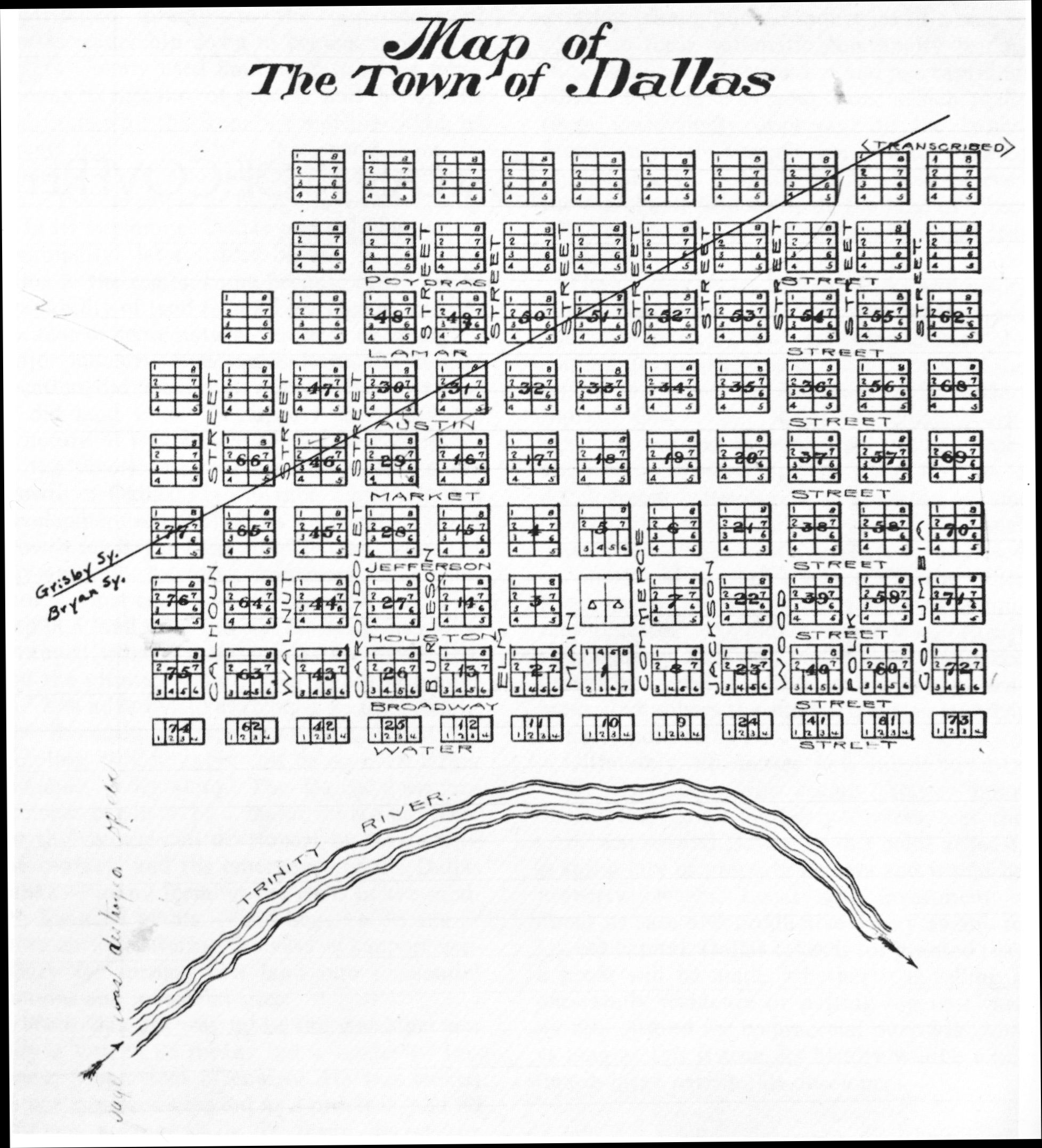
Dallas founder John Neely Bryan laid out the original town grid and named all the streets. His 1844 townsite was a one-square-mile grid plan with eight streets running north-south and a dozen running east-west. The original street names were as follows, and the origin information, if known from primary sources, is shown in brackets.
|
North-South Names
|
East-West Names
|
Austin [Stephen F Austin] | Burleson [Edward Burleson] |
| Broadway | Calhoun [John C Calhoun] |
Houston [Sam Houston}
| Carondalet [Francisco Luis Héctor de Carondelet]
|
Jefferson [Thomas Jefferson]
| Columbia [Columbia, personification of America]
|
Lamar [Mirabeau Lamar] | Commerce |
Market
| Elm
|
Poydras [Julien de Lalande Poydras] | Jackson [Andrew Jackson] |
Water [closest to the Trinity River] | Main |
| | Polk [James K Polk] |
| | Walnut |
| | Wood [George T Wood]
|
The juxtaposition of the Bryan and Grigsby grids is easily seen on this map. Note that the orientation of the map is North (left), East (top), South (right), and West (bottom). This map is located in the Dallas County Records, Deed Book D, page 688.