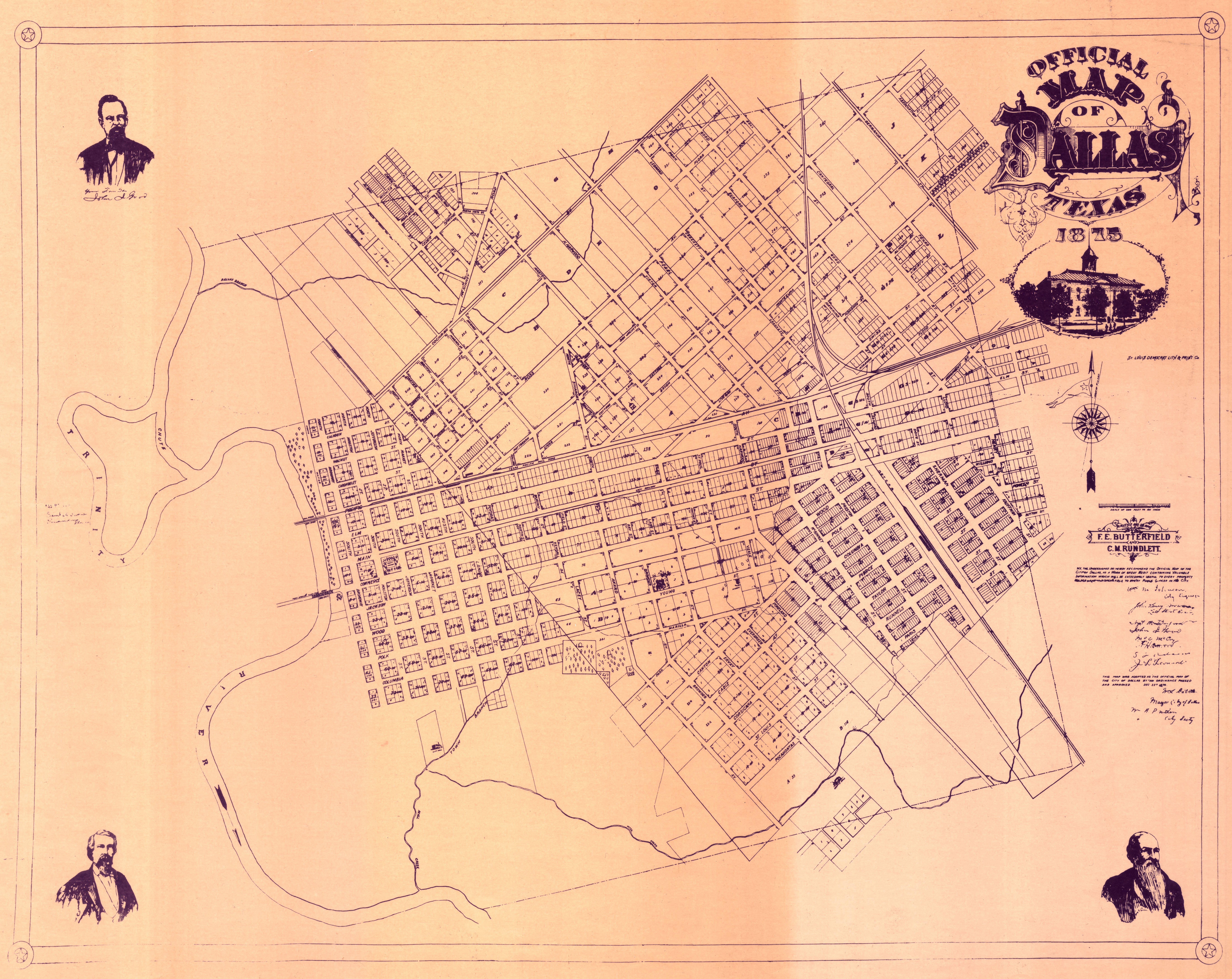
A glance at early maps of Dallas shows an interesting pattern for the streets. How did this situation arise? Between 1836 and 1844, three different surveys were conducted in the Dallas area. All were created with a specific logic in mind; seen as a whole, however, the different angles and orientations of Dallas streets can look confusing. The following three surveys formed Dallas's early city layout:
●
| 1836
Ferris grid—On behalf of land owner John Grigsby, surveyor Warren Ferris laid out areas of Dallas including Old East Dallas, Oak Lawn, and South Dallas. The grid is at a 45-degree angle and set along the cardinal directions. Ferris used this angle with intention; all buildings saw sunlight at least once a day, and no building faced directly north.
|
●
| 1841
Peters Colony grid—Surveyed under the auspices of the Peters Colony (impresario land grants allocated initially by the Republic of Texas and later by the United States). This grid was oriented on a regular north-south axis and encompassed a large portion of North Texas including what would come to be Dallas County.
|
●
| 1844
John Neely Bryan grid—Mapped out by John P Dumas for town founder John Neely Bryan, this one-half-square-mile grid was aligned perpendicularly to the Trinity River (in the river's original path). |
This 1875 map of the City of Dallas shows how the 1841 and 1844 grids abut. The 1836 grid encompasses more of what is now Dallas County. During these early surveys of the Dallas area, the land was in Nacogdoches County in the Republic of Texas.
 (Collection 1999-001—Map Collection)